Securing Mines: High-Precision Slope Displacement Sensors
Release time: 2026-02-28
Table of Contents
Open-pit mining and highway construction face a relentless enemy: gravity.
By the time surface cracks appear, the optimal time for safe evacuation has often passed.
Learn how slope displacement sensors can effectively prevent catastrophic engineering accidents.
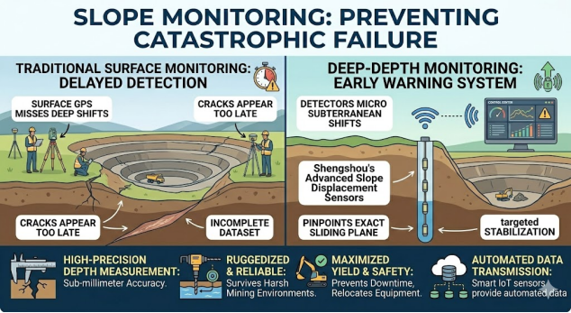
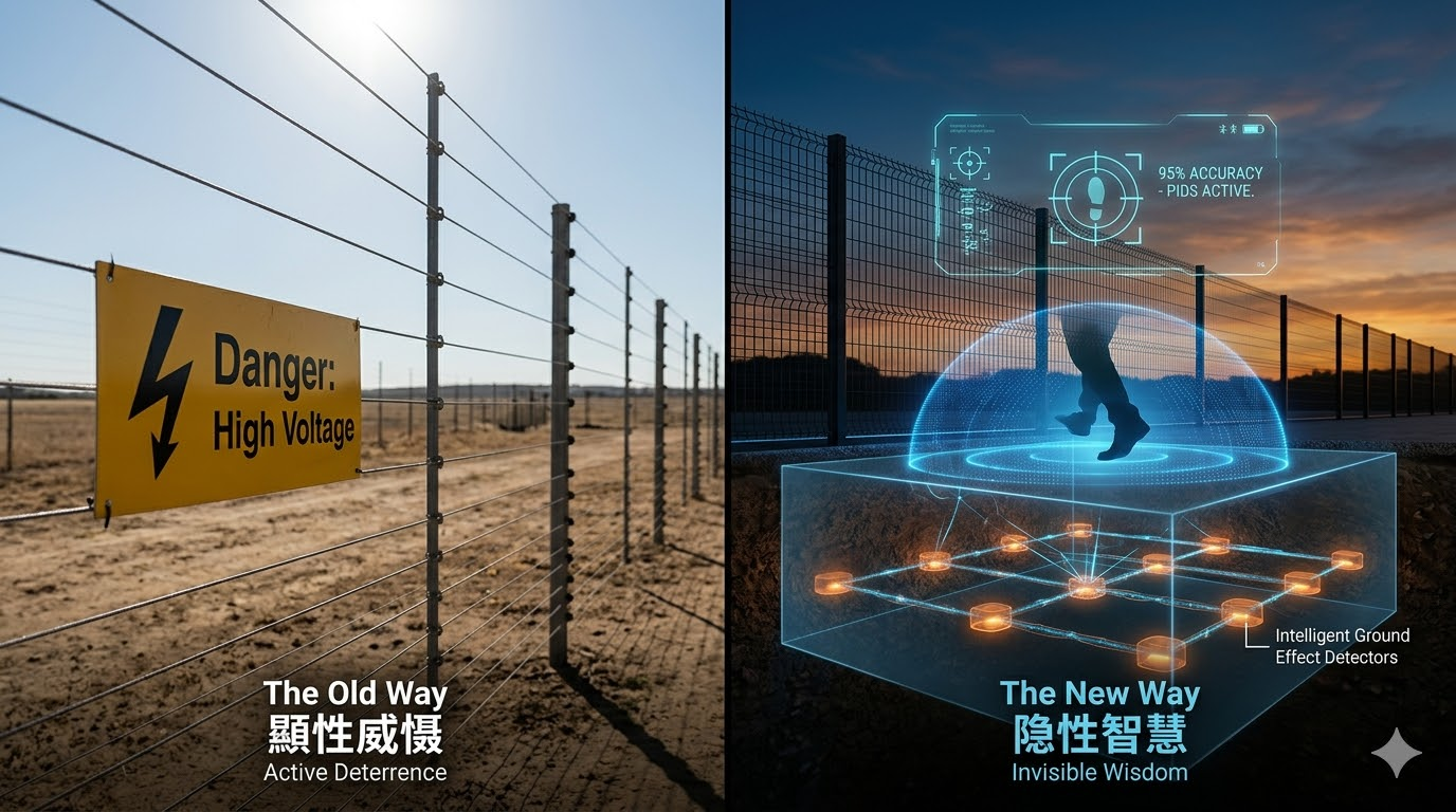
The Fatal Flaw of Surface-Level Geotechnical Monitoring
In the high-risk fields of heavy infrastructure and open-pit mining, slope stability is more than just a compliance check; it’s a matter of lives and multi-million dollar business continuity. For decades, engineers have relied heavily on surface-level monitoring equipment. While these traditional methods have their uses, they have a fatal flaw: they can only detect movement after underground damage has spread to the surface, leaving extremely short reaction times.
Why Traditional Optical and GPS Systems Fail
Surface prisms, GPS stations, and optical total stations are standard tools for tracking structural displacement. However, in complex geotechnical engineering environments, these instruments are merely stopgap measures. When a mountain slope begins to destabilize, the initial fracturing doesn’t occur where we can see it with the naked eye, but originates from hidden shear planes deep underground. Relying solely on surface data means engineers are essentially blind to deep deformations beneath the surface, losing crucial lead time for evacuation or structural reinforcement before a complete collapse.
The Hidden Dangers of Subsurface Shear Zones
The geological reality is that failure mechanisms are driven by deep shear zones. Water infiltration, heavy excavation vibrations, and natural geological faults create localized stress concentrations several meters below the bedrock surface. To capture these microscopic precursor movements, civil engineers need a specialized high-precision depth measurement sensor capable of reading sub-millimeter displacements within the lithosphere—all before surface fracturing. Standard surface surveyors simply cannot penetrate this critical depth.
How Slope Displacement Sensors Solve Complex Engineering Pain Points
Shifting from passive observation to proactive geological defense requires embedding technology directly into hazardous areas. The high-precision depth measurement mountain slope displacement sensor is designed to fill this monitoring gap, providing refined, actionable data from deep within the bedrock.
Precise Slip Surface Location
Unlike surface nodes, mountain slope displacement sensors are vertically mounted in strategic boreholes that traverse known geological faults. By cascading multiple sensor nodes along the borehole depth, geotechnical engineers can create a complete subsurface profile. When soil displacement occurs, the high-precision depth measurement sensor detects the exact depth and velocity of deformation. This allows project managers to precisely pinpoint the slip surface, enabling highly targeted grouting, anchoring, or controlled blasting to stabilize specific weak strata, rather than relying on guesswork to determine the failure point.
Surviving Harsh Mining Environments
Mining and highway slope cutting projects operate in some of the harshest environments on Earth. Extreme temperature fluctuations, abrasive dust, corrosive groundwater, and constant seismic impacts from heavy machinery render fragile surface optics extremely unreliable. The rugged slope displacement sensor is housed in an industrial-grade enclosure. This ensures uninterrupted data transmission even when buried deep in waterlogged mountain slopes, significantly reducing equipment replacement costs and maintenance downtime associated with fragile optics.
Automated Data Transmission and IoT Integration
Modern geotechnical engineering requires real-time intelligence. Advanced slope displacement sensors go beyond passively collecting data; they can serve as key nodes in a comprehensive on-site Internet of Things (IoT) network. Through robust connectivity, these sensors transmit continuous deformation data back to a central command center. This eliminates the dangers of technicians manually reading inclinometers in rockfall-prone areas, significantly improving personnel safety, while ensuring the data flow from slope displacement sensors is unaffected by adverse weather conditions.
Maximizing ROI for Heavy Infrastructure Projects
While the primary mission of slope displacement sensors is safety, their economic impact on large projects is equally profound. Smart geotechnical monitoring directly translates into higher operational efficiency and maximized return on investment (ROI).
Preventing Unexpected Downtime and Equipment Loss
Sudden landslides not only threaten lives; they can bury heavy machinery and cause indefinite production shutdowns. A shut-down open-pit mine or a blocked highway tunnel can result in hundreds of thousands of dollars in financial losses daily. By deploying a mountain slope displacement sensor network, operations centers receive automated, real-time alerts once deep deformation accelerates beyond a safety threshold. This early warning system enabled the orderly evacuation of personnel and the relocation of multi-million dollar excavators to safety before a mountain slope collapsed.
Data-Driven Mining and Output Optimization
Conversely, overly conservative safety margins severely limit the profitability of mining operations. If engineers cannot accurately measure the stability of a mountain slope, they must leave large amounts of valuable ore as natural supports. Continuous data from high-precision depth measurement sensors allows engineers to confidently push excavation angles to their absolute maximum safety limits. This data-driven approach maximizes resource extraction and project output, demonstrating that advanced slope displacement sensors are not merely a safety expense, but a crucial tool for ensuring operational profitability.